Features ▾
About
Pricing
Resources ▾
More...
Read the shape of your land
Elevation, contour maps, aspect, slope, and hillshade. Everything beneath your feet, rendered clearly for design and analysis.
Know your vertical range
See the high and low points across your land. Understand elevation changes that affect drainage, microclimates, access, and design possibilities.
Map your landforms
Generate contour maps at any interval to understand slope patterns, grading needs, and landform structure.
Move to design software
Download contour lines as DXF files for AutoCAD and other design software. Ready to use in your design workflow without redrawing.
Know your orientations
Map the directional orientation of every slope on your land. Aspect determines sun exposure, wind patterns, and microclimates.
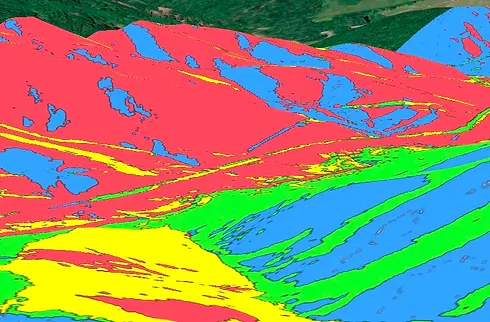
Understand your gradients
Visualize slope angles across your entire land. Identify areas suitable for building, planting, or terracing, and see where erosion control or stabilization may be needed.
Visualize relief and terrain
A 3D perspective of your land's surface. Hillshade reveals ridges, valleys, and subtle landforms that flat maps can't show.